
SPITSBERGEN / SVALBARD

SPITSBERGEN / SVALBARD
SPITSBERGEN
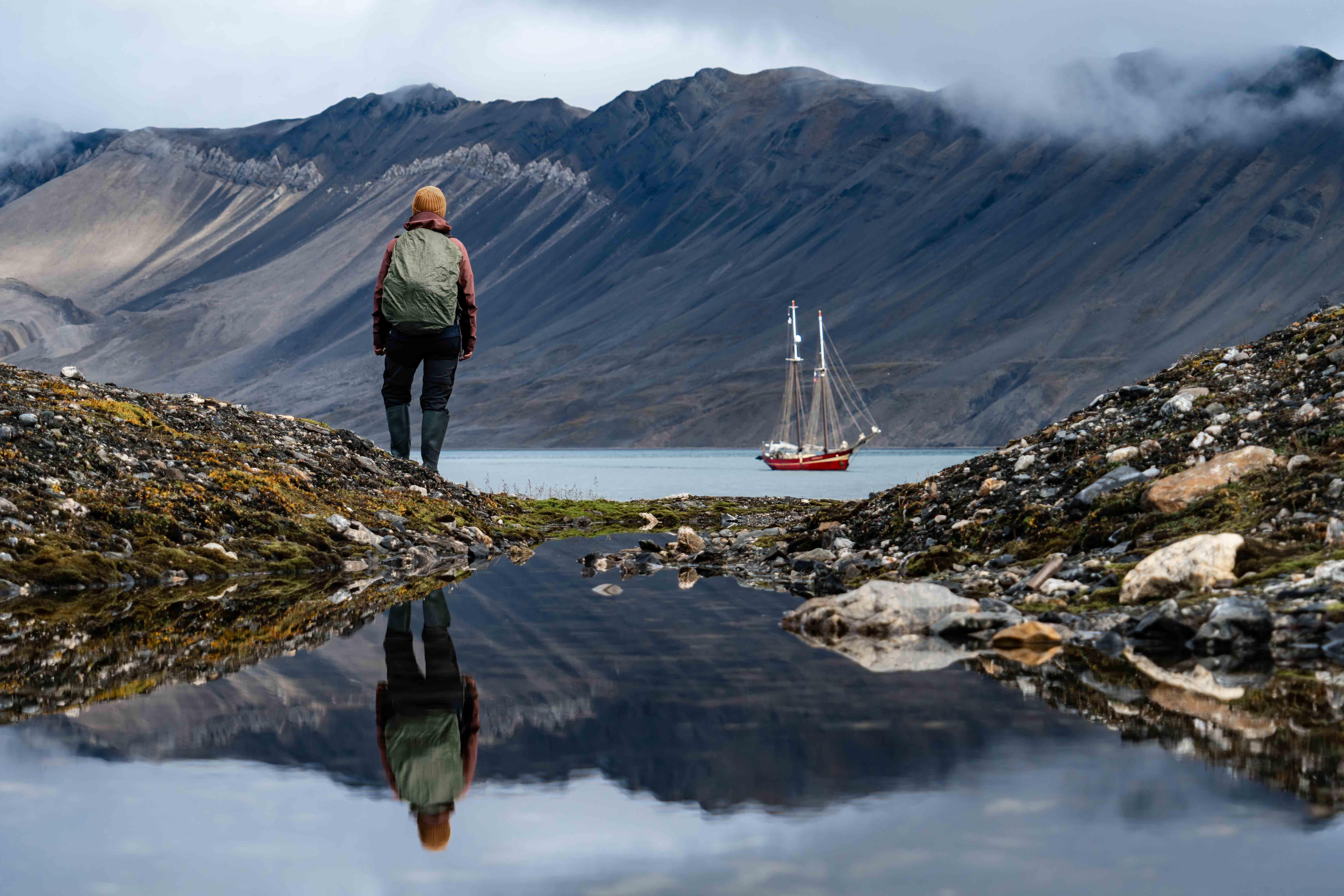
EXPEDITION TO SPITSBERGEN
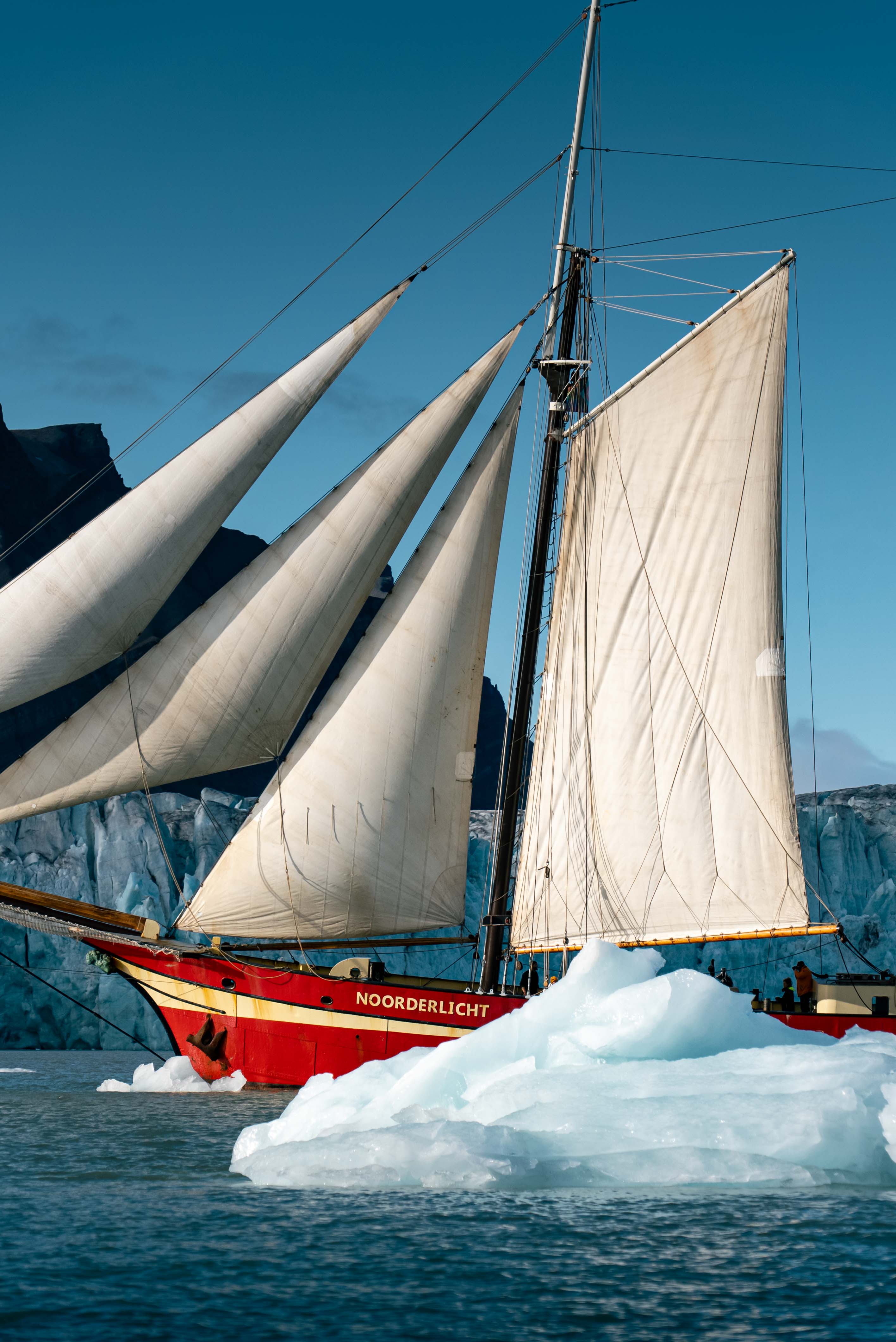
Tall Ship Noorderlicht has almost 30 years of experience in Spitsbergen. With us you will experience the Arctic wilderness with spectacular glaciers, encounters with Arctic animals and dive into the history of Spitsbergen.

Sailing in Spitsbergen..?
Yes, only with a sailing ship you can discover the real Spitsbergen on a voyage between 7 and 16 days. Larger and only motorized ships are increasingly banned from the most beautiful and vulnerable places.
Smaller ship = better experience
In the past 30 years that we execute sailing expeditions in Spitsbergen, we have also seen an increase of mass tourism. Fortunately, the Norwegian government is making rules to protect vulnerable areas from the larger, motorized ships of up to 200 passengers. Tall Ship Noorderlicht with only 20 guests is still allowed to visit those places.
Characteristic vessel
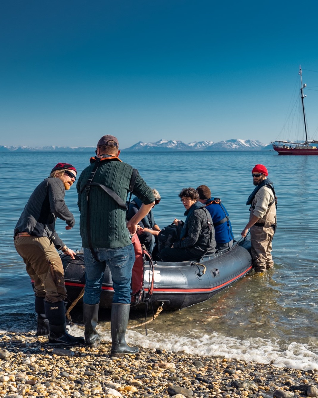
Landings
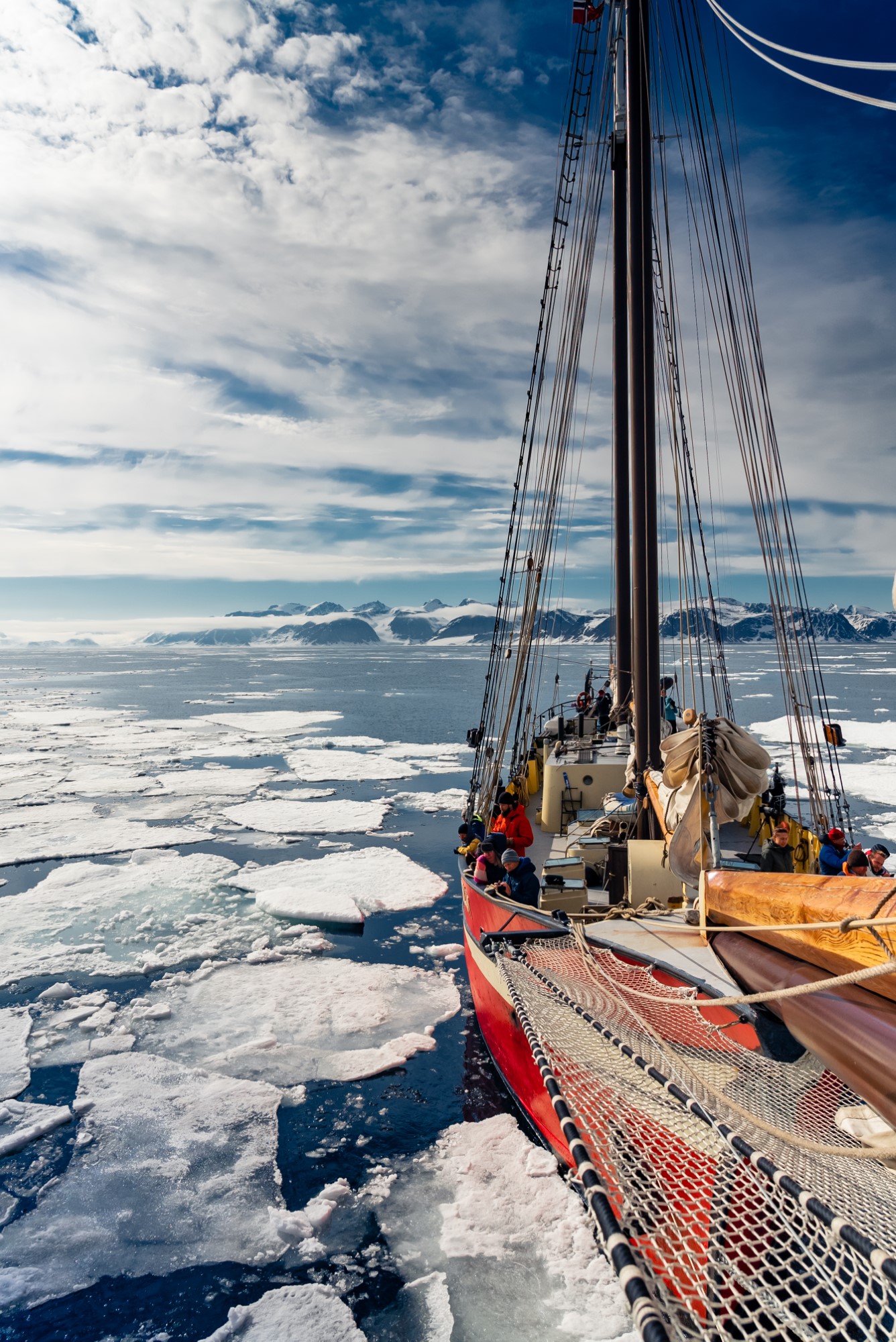
With our 30 years of experience in Spitsbergen, we anchor in the most beautiful, most remote fjords and bays of Spitsbergen. With an expedition zodiac we will take you ashore. Our certified guides will always ensure a landing you will never forget. The primeval ice, the glaciers, the wild life. Because we sail with a maximum of 20 guests and we are a relatively small sailing ship, you are able to enter into the real untouched nature of Spitsbergen. An shore-expedition lasts from a few hours to a maximum of half a day.
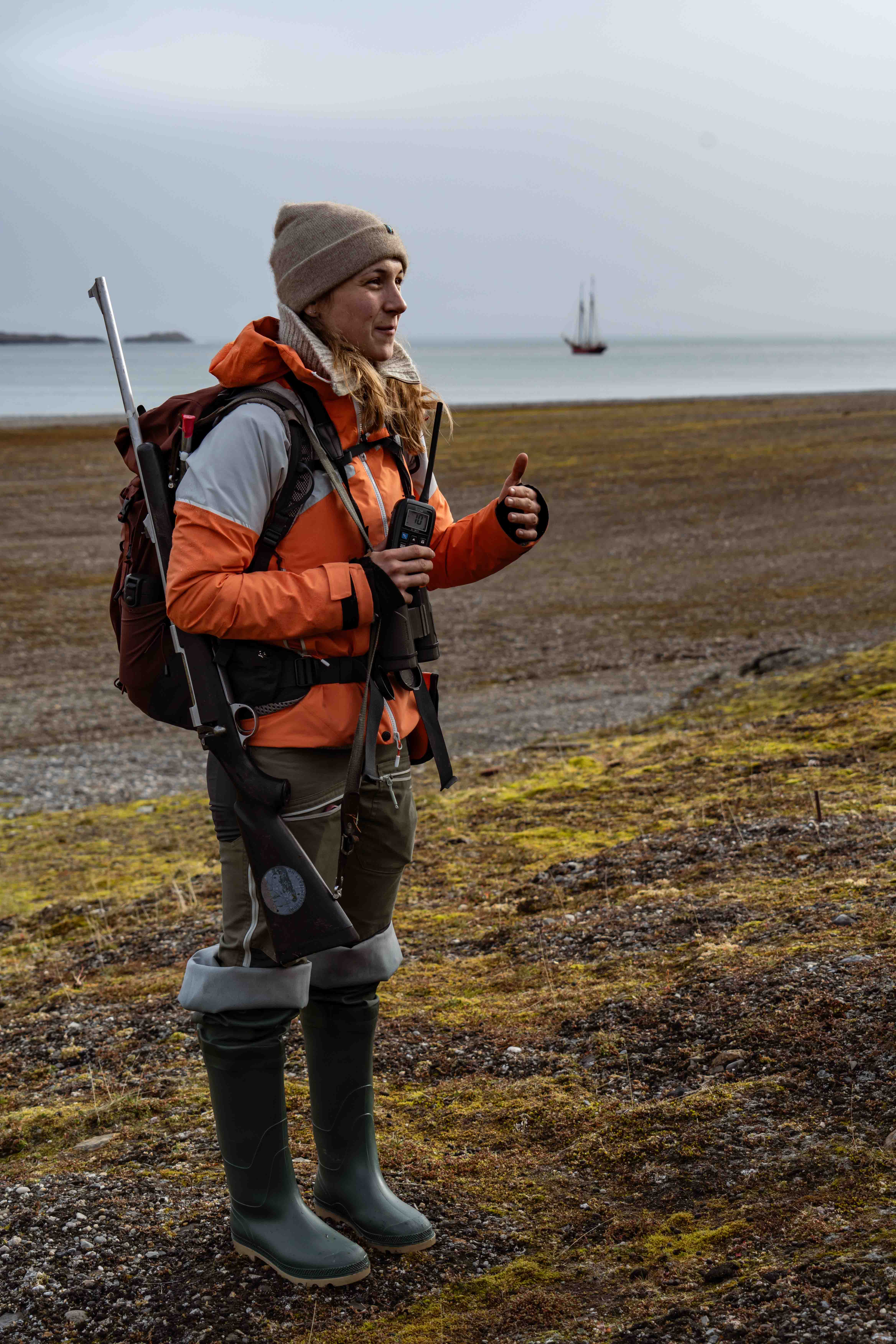
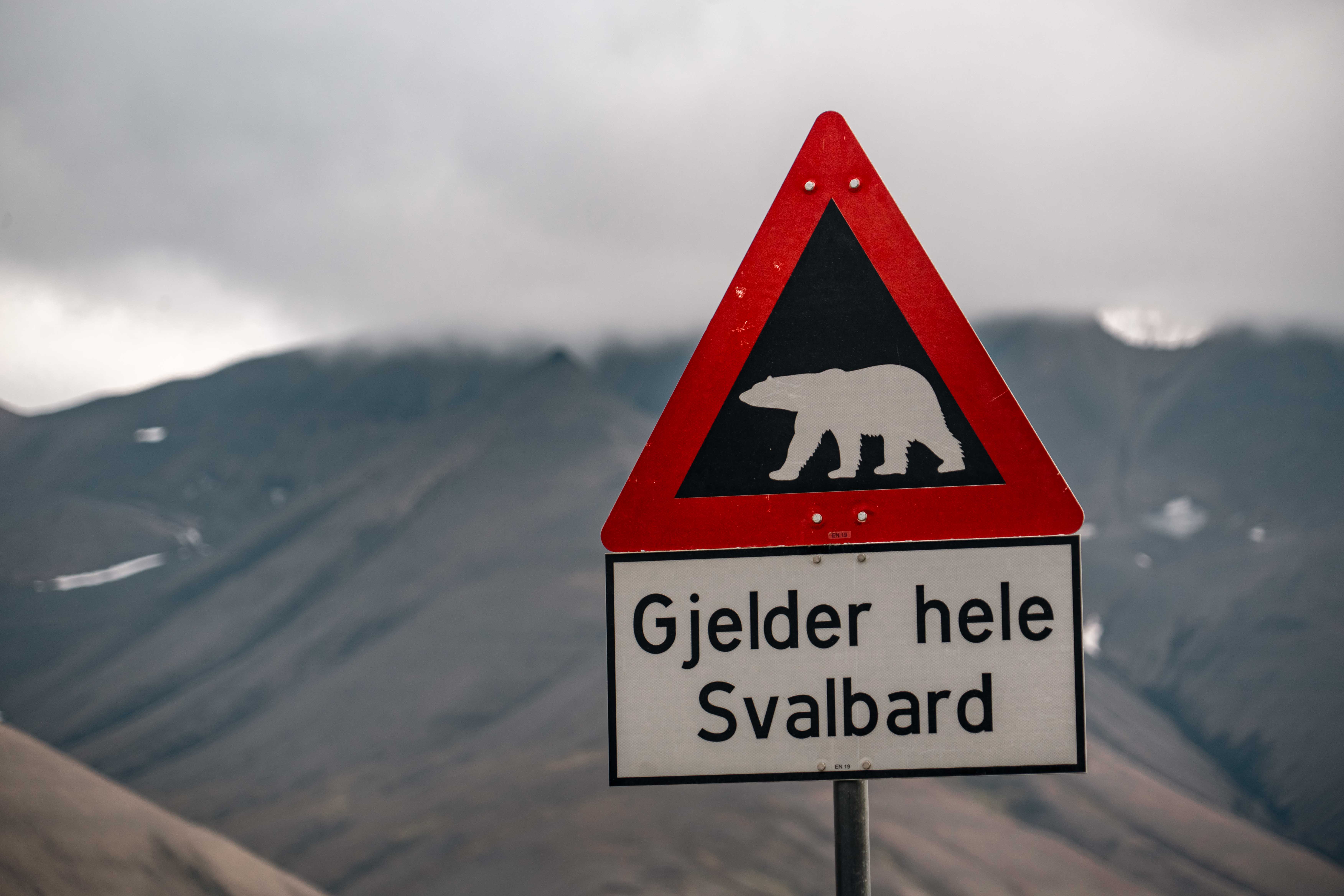
Polar bears
Anyone traveling to Spitsbergen dreams of spotting a polar bear. With over 30 years of experience and the most up-to-date knowledge, we do our utmost to make this possible. However, our priority is to respect the polar bears and allow them to go about their natural behavior undisturbed.
Polar bears are wild animals, and it’s important that we do not interfere with their environment. If we are fortunate enough to have a polar bear nearby, we observe them from the safety of the Noorderlicht. We do not actively seek them out, nor do we want to encounter polar bears on land—it’s too dangerous for both us and the bear.
Our philosophy is clear: to travel with care and to leave as little impact as possible on Spitsbergen’s fragile ecosystem while ensuring the wildlife remains wild.
Armed guides
Environmentally Friendly
We are proud that we are a sailing ship and we try to use our sails to reach the expedition areas under sailing. Only that aspect already makes Noorderlicht unique in Spitsbergen. Most other ships are motor ships with all its consequences.
Electricity aboard
We also need electricity on the Noorderlicht. However, still our footprint is very low compared to the big vessels of up to 200 passengers. We get the energy that we need from our Powerpacks. We have 3 generators on board. Two small and ones and one larger one. This way we can always choose which one needs to be running for what we are doing, so we always have the configuration with the smallest impact on the environment.
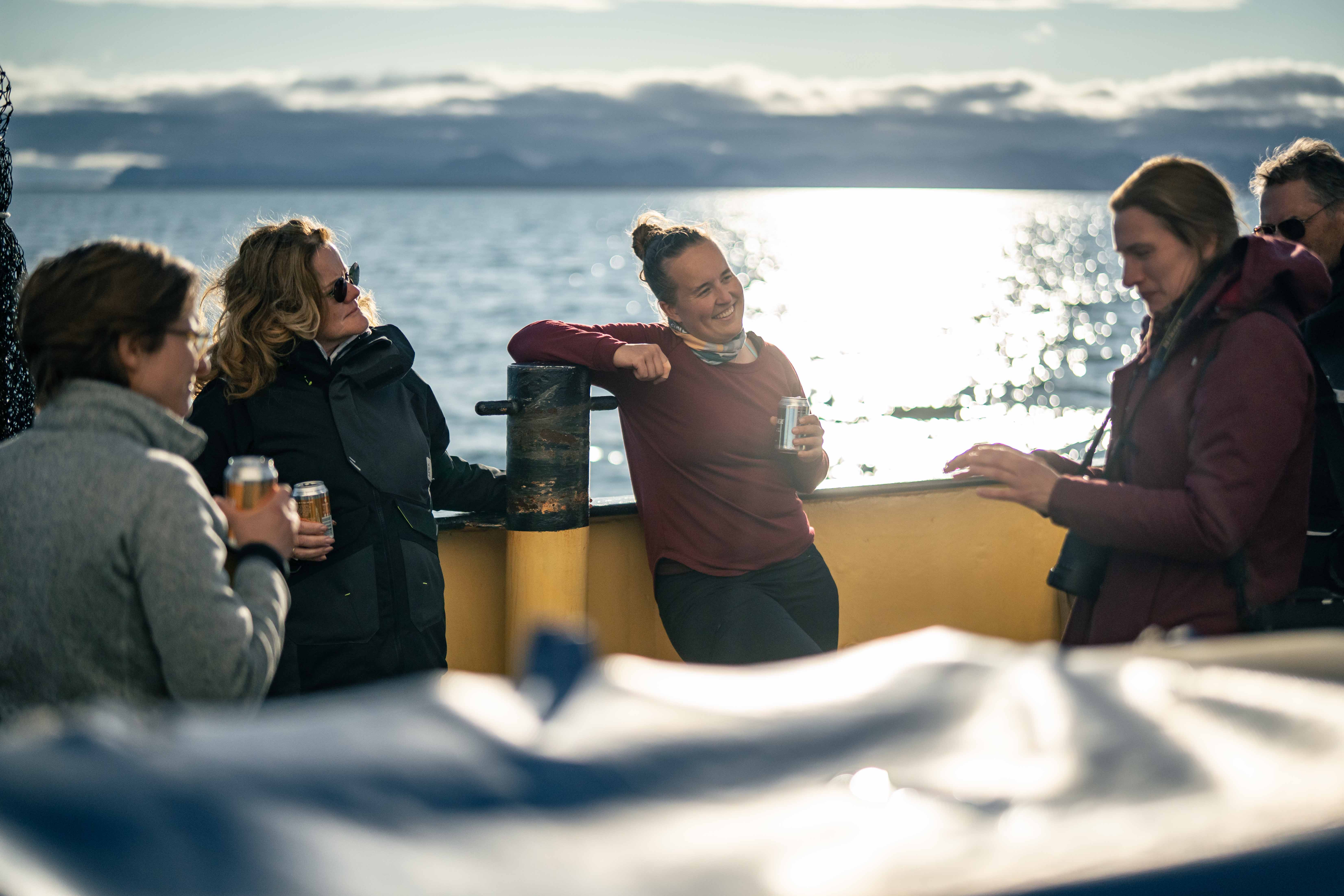
Life on board
What immediately stands out is the warm and cozy atmosphere in the ship. There are nice common areas that can be heated well for the arctic areas. There are also 10 comfortable double cabins. Living together on board is a fantastic experience, regardless of your age. The group process is one of the most important parts of an expedition.
Sleeping
Tall Ship Noorderlicht has 10 cabins, each accommodating two people. While the ship is equipped with ample space and comfortable facilities, current regulations allow us to sail with a maximum of 12 passengers. Some cabins share a shower and toilet with one other cabin, while others use the shared sanitary room.
Onboard, practicality takes precedence—this is why there are no double beds. A sailing ship’s natural heel makes them less comfortable. Instead, each cabin features two single beds in a bunk bed arrangement, ensuring a pleasant and safe stay for all.
Private Cabin
Food
Daily routine
After breakfast usually follows the first expedition or landing of the day. Lunch on board is after the first landing/expedition, between 12 noon and 2 pm.
Sailing / second landing
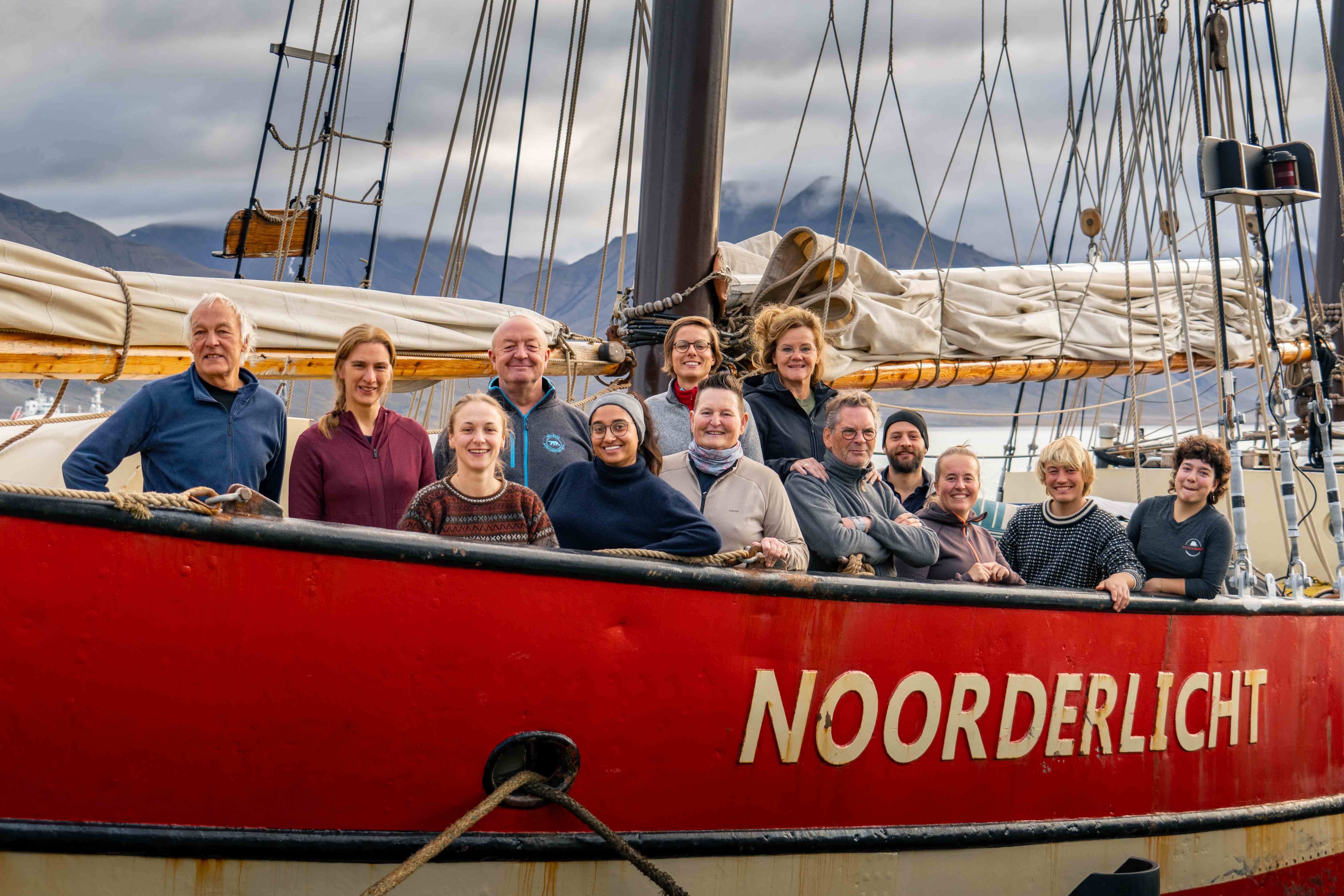
Our team
Our ships are sailed by an international, professional crew. On board we have a captain, mate, cook, deck crew, and 1 or 2 guides. Total maximum 5 crew members and 2 guides. They are together responsible for a safe trip and are therefore trained and certified on the basis of internationally applicable regulations. Our cook provides daily breakfast, an extensive lunch (often hot) and dinner. Dietary preferences can also be taken into account, such as meatless and allergies.
Guides
Our guides are fully certified and have extensive experience leading landings and expeditions. They have different areas of expertise. One knows a lot about flora and fauna, the other knows a lot about the history of Spitsbergen or about the impact of the changing environment in the polar regions.
Customized experience
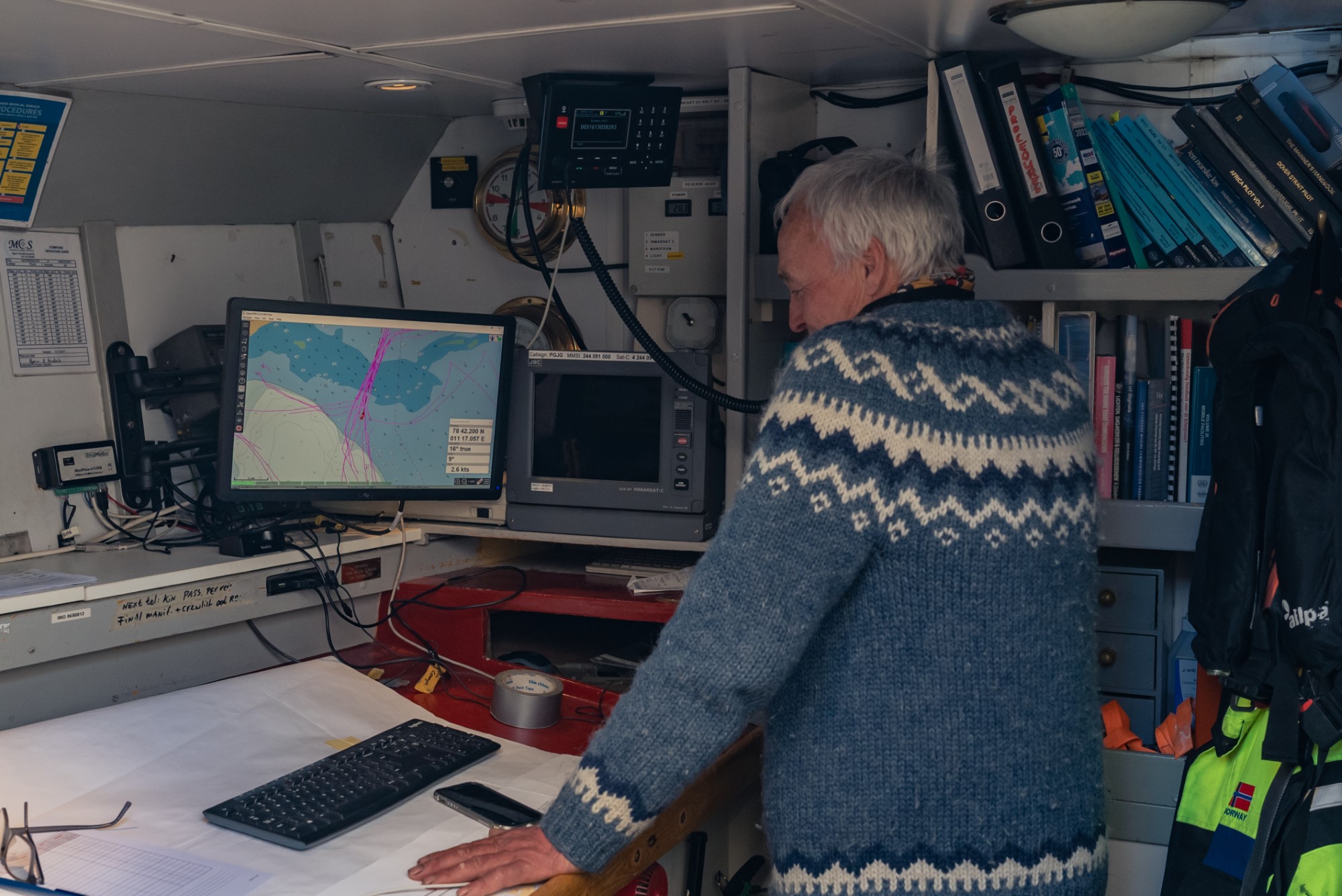
Communication
As soon as the Noorderlicht is a few miles out to sea, a sense of calm descends on the ship: there is no longer a cell phone connection. Can you imagine? A day without your mobile? This is your life aboard our vessel. There is no contact with the outside world. Or, at least almost ...
Satellite telephone
Of course there are other ways in which Tall Ship Noorderlicht can be in contact with the outside world 24/7. For example, we have an iridium LT 3100 satellite telephone connection which we can always use to call and be called in case of emergency.
Crewmeeting
History of Tall Ship Noorderlicht
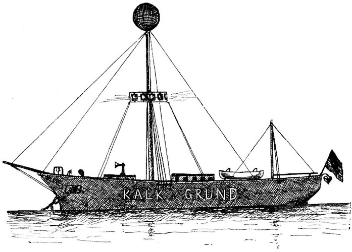
The history of Tall Ship Noorderlicht begins a century ago as the lightship Kalkgrund II. The ship was originally rigged as a three-masted schooner and not equipped with an engine. The ship already has a really beautiful hull.
From lightship to houseboat
After being used as a lightship for a while, the ship is converted into a houseboat. Unfortunately, it fell into a bad condition… But the rusty hull was refitted into an expedition ship in 1992. We are then one of the first ships to take guests to the still unknown Spitsbergen.
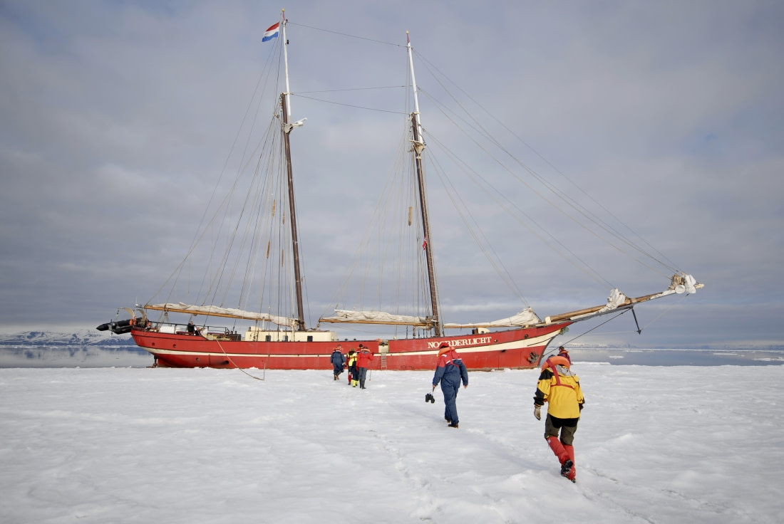
Frozen in the ice of Spitsbergen
Noorderlicht Details
Length 46,2 m
Width 6,5 m
Mastheight 43 m
Hullspeed 12 knots
Sailing plan 550 m2
Flag Holland
Homeport Enkhuizen
Built 1910
Rebuilt 1993
Certificates Worldwide
Crew 5-7 persons
Trainees 20 persons
Engine 340 HP Caterpillar D343 Diesel
Safety and certification
Safety requirements
Noorderlicht meets all safety requirements set by the International Maritime Organization (IMO). The crew and guides are well trained in dealing with emergencies, but especially in preventing them. Every year, the entire ship and crew are inspected by various government agencies.
This already starts when you step aboard the ship. As a new crewmember you will be part of our safetydrills that take place during the start of our expedition. Do you have questions regarding safety aboard? Do not hestitate to ask one of our crewmembers about it during your stay.
Booking and Costs
Cost
Although our expeditions on our sailing ships are the most unique of all the voyages you can make on Spitsbergen, they are still very affordable. A 7-day expedition costs about 2500 euros and a 16-day circumnavigation towards 5.500 euros (VZR garant has secured the paid travel money. More about it here).
Full board
That is based on full board, coffee, tea, juice, etc. Only your personal (alcoholic) drinks are for your account. The flight and your transfer from Longyearbyen airport to your ship (15 min) is not included.
Payment
Payment for the expedition is always in advance by bank transfer. You pay for your drinks on board the day before departure by (credit)card.
When you have found your expedition of choice, you can start booking. For expeditions of more than 3000 euros that are booked more than 60 days in advance, you only pay 30% first. If the expedition is already within 60 days of booking or for less than 3000 euros you pay the entire travel sum direct.
Merchandize
We have a number of unique items for sale on board. Think of sweaters, polos and caps that you will either wear yourself and that remind you of your expedition on Noorderlicht. Or you can take it with you for your friends or family at home where everyone is curious about all your stories.
Tipping
It is customary for guests to tip the crew. This can be arranged when paying for your drinks and merchandise on the last day. For example, consider 5% of the travel sum.
Personal Account
With your booking you will receive a link to your personal account. There you will find all information about your expedition. We also ask you to complete your personal information in your account. Do you pay in partially payments? Then you will also find the second invoice in your personal account 2 months before the trip.